|
| *****SWAAG_ID***** | 398 |
| Date Entered | 14/12/2011 |
| Updated on | 14/12/2011 |
| Recorded by | Tim Laurie |
| Category | Settlement |
| Record Type | Archaeology |
| SWAAG Site | Downholme Moor |
| Site Access | Army Range |
| Record Date | 01/01/2005 |
| Location | Downholme Park |
| Civil Parish | Downholme |
| Brit. National Grid | NZ 1162 0016 |
| Altitude | 200m |
| Geology | Drift on lower dale slopes below the Main Limestone (Red Scar). |
| Record Name | Downholme. Settlement, cultivation terraces and field system at Downholme Park |
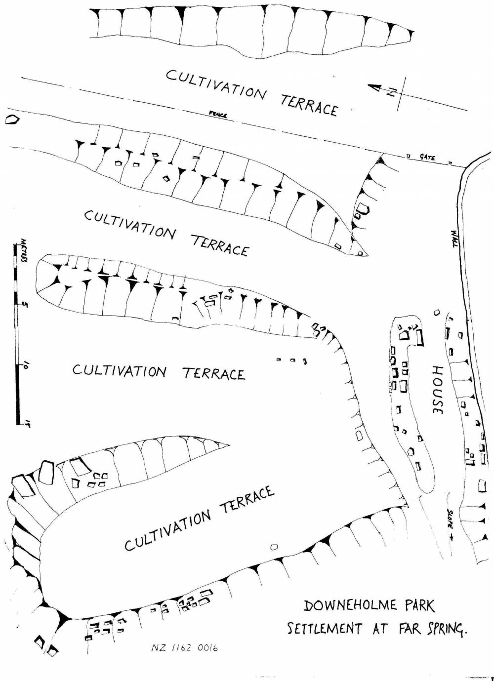
| Record Description | See Plan Figure DOW 42.1
Single narrow rectangular building slightly bowed long walls with entrance in east gable marked by orthostats associated with a group of cultivation terraces and a coaxial field system (DOW46) with boundary banks running downslope through the pastures above Downholme Park.
Rectangular buildings with slightly bowed sides and gable entrances are considered to be pre-conquest in date. Very few examples survive, most presumably having been replaced by later farmsteads and villages.
Dated settlements with buildings similar to this include the excavated settlement at Ribblehead, King 19** and those at Simey Folds in Upper Teesdale, Coggins and fairless 19**.
Hoever, ther is no dating evidence for this site and an open mind must be mainained on the period of occupation here.
|
| Dimensions | See plan |
| Additional Notes | This survey was completed (for the Catterick and Feldom Ranges Conservation Group Monograph Series) many years ago and this site has not been published elsewhere.
This isolated building together with its cultivation terraces could provide an insight to medieval or pre-conquest Swaledale. |
| Image 1 ID | 1716 Click image to enlarge |
| Image 1 Description | Site plan. Rectangular building and cultivation terraces. | 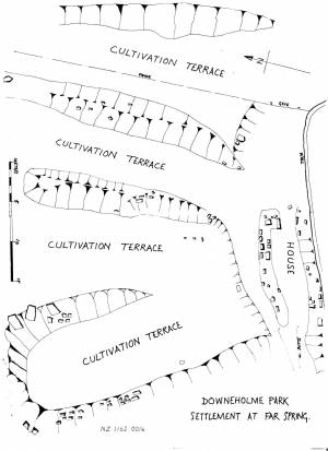 |
| Image 2 ID | 1713 Click image to enlarge |
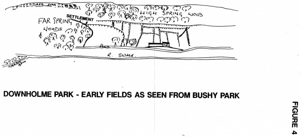
| Image 2 Description | Downholme Park. Location of Settlement and field system at Downholme Park as seen from Bushy Park. |  |
| Image 3 ID | 1718 Click image to enlarge |
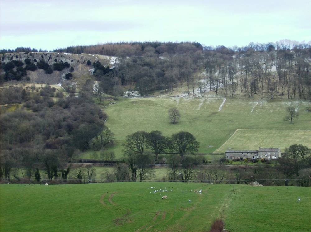
| Image 3 Description | Downholme Park. Location of Settlement and field system at Downholme Park as seen from Bushy park |  |